
Walk a Port St. Lucie Street
The soundest street search moves from the physical parcel to separate records, one source at a time. The Saint Lucie County Property Appraiser Real Estate Search establishes the current parcel, situs address, owner of record, and legal description. A situs address labels the land or building. It should not be confused with the owner's mailing address, which is simply where tax notices go. The street directory becomes more reliable only when those fields are kept separate.
Follow this order for one house, then repeat it for nearby parcels. It preserves the links between a street number, Property ID, subdivision, lot, block, and recorded deed.
- Search the complete Port St. Lucie address in the Property Appraiser system. Save the Property ID, owner, situs address, mailing address, and legal description.
- Open the parcel in the county map and click outward to the parcels next door. Check the city-boundary and subdivision context before assuming City Hall has the file.
- Use the owner name and deed reference in the Clerk's official-record index. The deed names the grantor, the transferor, and the grantee, the recipient.
- Check Port St. Lucie permit history under both current and legacy address rows. Permit records can date work at the site, but they do not prove who occupied it.
- For a lawful voter-record need, request the proper county extract. The self-status tool verifies one voter and is not an open street roster.
For older occupants, the historical shelf is a separate task. The Port St. Lucie city directory collections explain how early county and Fort Pierce headings can supply address evidence without treating a modern parcel roll as a household list.
Port St. Lucie Parcel Terms
Several record terms keep a Port St. Lucie street directory accurate. The street number is convenient, but the legal description and Property ID provide continuity when an address is abbreviated or stored differently. A plat is a recorded plan that divides land into lots, blocks, roads, and other features. It can connect a present street address to the wording in an older deed.
- Parcel
- A mapped unit of land used for assessment and record links.
- Situs address
- The physical location label attached to the parcel, not the tax-notice destination.
- Plat
- A recorded land-division map that identifies subdivisions, blocks, and lots.
- Criss-cross directory
- A directory arranged by street and number rather than only by surname.
Port St. Lucie's original numbered subdivision sections make lot and block especially useful. Newer areas west of Interstate 95 may instead have master-planned plats and association documents. Use the development era to choose the next record.
A parcel result should be inventoried before moving to another portal. The county card and GIS provide several fields that serve different jobs in the Port St. Lucie street directory.
| Property ID | Stable join key for the assessment card, GIS, and downloadable county data. |
|---|---|
| Owner and addresses | Owner name plus separate mailing and situs addresses; neither names every occupant. |
| Legal description | Subdivision, lot, block, or other land description used to connect deeds and plats. |
| Use and year | Land or building characteristics that help distinguish similar parcels. |
| Values and exemptions | Assessment facts, including homestead when shown, not a complete residency finding. |
| Districts | Taxing and jurisdiction context that can help route a local records request. |
| Sales and deed reference | Transfer dates and references that point into the Clerk's recorded instruments. |
| Map links | The route to parcel geometry, adjacent lots, city boundaries, and subdivision context. |
Copy these fields together. A street spelling can vary between current and legacy systems, while the Property ID and legal description keep the land record anchored.
Search Port St. Lucie Permits
The city's Building Property Search is a strong by-address layer. City instructions say that less is best: enter a house number and a useful street token, submit the search, and open the Property KEY. If the first search fails, try only the house number or street. The system may display one address from current data and a second from legacy data. Open both, even when they appear to describe the same place.
| Permit field | Input | How to use it |
|---|---|---|
| House # | Text, optional | Use digits without special characters |
| Street | Text, optional | Try a distinctive token instead of a long exact form |
| Direction | Text, optional | Preserve the quadrant prefix |
| Section, Block, Lot | Text, optional | Match the subdivision fields on the parcel card |
| Submit / Clear | Buttons | Review both current and Legacy Data results |
The successful manifest capture shows the city permit search interface. 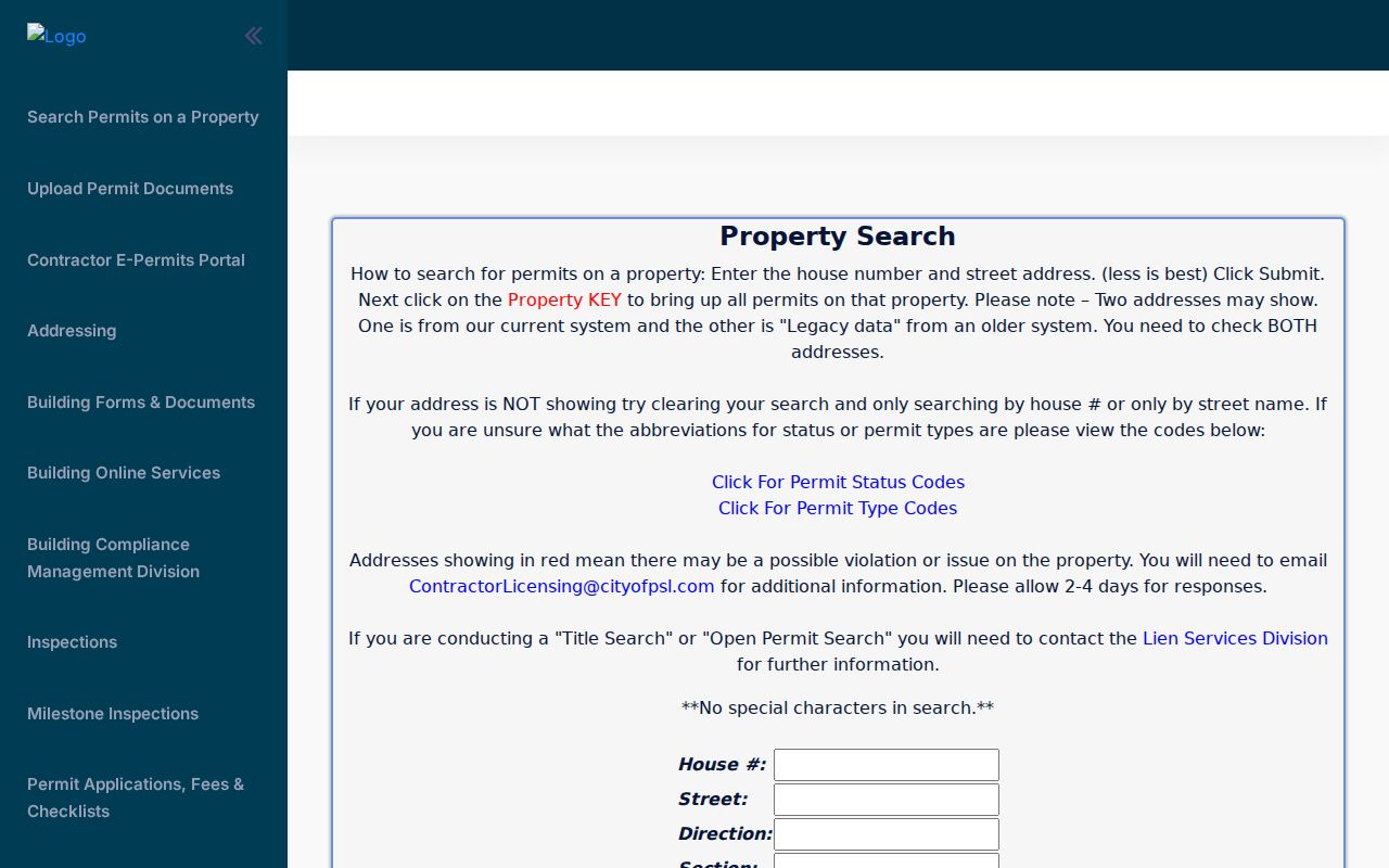 Its address fields support a careful street search, while the returned permit list helps date public work rather than identify a full household.
Port St. Lucie Street Prefixes
Quadrant letters are part of the address. SW Port St. Lucie Boulevard and SE Port St. Lucie Boulevard are different search strings, so dropping SW, SE, NW, or NE can mix records. The city permit advice to use fewer terms helps with legacy abbreviations, but the returned row still must be checked against the parcel's Property ID and legal description.
The same caution applies at a postal edge. River Park has deep ties to Port St. Lucie history and mail, yet it remains outside the incorporated city. A Port St. Lucie mailing label does not prove municipal jurisdiction. Confirm the city-boundary layer before asking City Building or Code Compliance for a street file.
Note: A ZIP code narrows delivery geography, while the county parcel and city-boundary layer decide which local office is likely to hold the address record.
Port St. Lucie Street Records
No single roll answers every Port St. Lucie street directory question. Property and GIS records identify parcels and owners. Deeds show transfers. Municipal permits and code files document activity tied to an address. Voter data can show registered people when lawfully obtained, but protected addresses and confidential identifiers are withheld. Each record speaks to a different fact.
| Record Set | Keeper | What It Shows | Access |
|---|---|---|---|
| Property roll | Saint Lucie County Property Appraiser | Owner, situs and mailing address, exemptions, sales | Free parcel search |
| GIS tax map | Property Appraiser | Adjacent parcels, city boundary, subdivisions, tax-map context | Free viewer and downloads |
| Deeds and liens | St. Lucie County Clerk | Transfers, party names, legal description, instrument images | Free index; certified copies cost extra |
| Voter records | Supervisor of Elections | Public registration fields, subject to protected-address rules | Individual check or requested extract |
| Building permits | Port St. Lucie Building Department | Property key, permits, inspections, current and legacy address rows | Free web search |
The chain works because the Property ID and legal description tie the parcel map to the assessment roll and deed. The city property key ties the same site to permit files. Names and street addresses then support a narrower voter-record request. When the interactive map is too slow for a whole street, the Property Appraiser offers free CAMA and GIS downloads joined by Property ID, plus scoped custom-data requests at actual labor cost.
The download route matters in a fast-growing city. Port St. Lucie reached an estimated 258,575 residents in 2024 and covers 119.22 square miles. A manual click-by-click browse can miss a parcel on a long road or across a subdivision edge. The county's combined assessment and GIS files make a whole-street comparison possible without treating the map screen as a complete resident roll. Ask for a concise scope. Staff contacts data requesters within two business days to define the request and any cost.
Browse Port St. Lucie Parcels
The Property Appraiser Search by Map turns one address into a street-by-street view. Find the first parcel, inspect its details, and click each adjacent polygon. Useful layers include parcels, city boundaries, subdivisions, condominiums, and tax-map context. The public TaxMap service supports identify, find, and query functions, with a maximum record count of 1,000 and selection count of 2,000.
The official tax-map layer service is shown in the captured image. 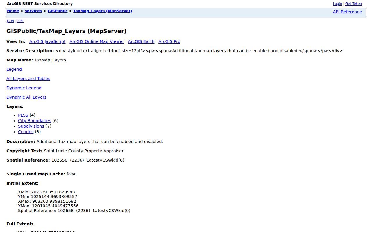 It confirms which map layers are available and helps explain why a parcel map is an assessment tool, not a survey or a list of all residents.
Deeds Along Port St. Lucie Streets
The St. Lucie County Clerk is both recorder and court clerk. Its Acclaim Official Records system covers modern documents from 1980 forward, including deeds, mortgages, liens, plats, judgments, and other recorded instruments. Search the parcel owner as a grantee to find the purchase. On that deed, the grantor is the prior owner. Repeating the grantor-as-grantee search builds a chain backward.
A second historical deed interface covers 1905 through 1960. The 1960 through 1979 band is still a transition area, so use Clerk staff, book indexes, or the Recording counter when the online systems do not connect. Copies and certification may cost extra, although public index and image access is free. A missing web result is not proof that no deed exists.
Note: Execution and recording dates can differ, so preserve both dates, the instrument number, book and page, party role, and full legal description.
Port St. Lucie Voter Addresses
Florida voter-registration records are generally public under section 97.0585. Name, residence address, birth date, party, phone, and email may be public, but Social Security numbers, driver-license or state-ID numbers, registration source, and copied signatures are not. Address Confidentiality Program participants and qualifying protected professionals can shield designated information.
The county voter-information lookup is an individual verification tool, not a Port St. Lucie street browse. A broader extract must be requested from the Supervisor of Elections. Available sort choices include precinct street and household, while geography filters include city and precinct. The office quotes the amount and applies statutory protections before release.
Request choices also include lists, labels, or a text file, with alpha, precinct alpha, precinct street, and household sort orders. Filters can cover registration dates, party, age range, voting history, and named elections. Vote history records whether someone took part, never how a ballot was marked. State monthly extracts arrive by disk through mail or pickup rather than by email download.
Street Events Are Not Residents
Port St. Lucie's address databases include unusual public clues. The garage-sale register can show a permitted sale address, ZIP code, dates, times, and broad item categories. Code files may show conditions and complaints. Since Florida SB 60 changed the process in 2021, most code complainants must give a name and address unless an inspector reasonably believes an imminent threat exists.
Neither source establishes permanent occupancy. A garage sale is a dated event. A complainant may live elsewhere, and a permit applicant or contractor need not be the resident. Use these files to date activity at a parcel, then compare the Property ID, deed, or another independent record before drawing a conclusion.
Limits of Port St. Lucie Street Records
A tax-roll owner is not automatically the resident. The owner may receive notices elsewhere, a homestead exemption does not identify every household member, and renters often do not appear on the parcel card. Deeds prove interests in land, not day-to-day presence. Permit, voter, and directory evidence can narrow a question, but no public Port St. Lucie street directory lists every person at every home.
Driver and vehicle address data is protected by Florida law and the federal Driver's Privacy Protection Act. Utility customer lists are not a public household substitute. Safe Address participants and other protected people may have address fields withheld. Respect those gaps rather than trying to work around them.
Lawful use. Port St. Lucie address records are for lawful personal research. Florida law prohibits stalking, harassment, threats, and harmful misuse of personal information.