
Port St. Lucie ZIP Coverage
Six ZIP codes recur across official Port St. Lucie material, with a seventh at the Fort Pierce postal edge. These are useful search zones, not legal neighborhood borders. Official facilities provide reliable geographic anchors, while county GIS supplies the final jurisdiction check.
| ZIP | Areas Covered | Post Office | Notes |
|---|---|---|---|
| 34952 | East and southeast, Morningside, Port District, River Park vicinity | Midport, 2255 SE Veterans Memorial Parkway | Check eastern parcels against city limits |
| 34953 | Southwest, Gatlin, Rosser, and Becker corridors | Official station not verified | Broad fast-growth postal area |
| 34983 | North-central and east-central, Prima Vista and Airoso | Official station not verified | Crosses more than one quadrant |
| 34984 | Central and south-central city | Official station not verified | Includes City Hall and river/canal addresses |
| 34986 | St. Lucie West and northwest | Port Saint Lucie, 290 NW Peacock Boulevard | USPS station result displays 34986-9998 |
| 34987 | Tradition and western expansion | Official station not verified | Recent plats and permits are strongest |
| 34982 | Northern and eastern edge context | Official station not verified | Fort Pierce postal area; verify city jurisdiction |
The Port St. Lucie postal directory does not list a local PO-box-only or unique institutional code because the official sources reviewed did not verify one. Likewise, no authoritative local split year was found. Those are gaps, not facts to fill with assumptions.
Eastern Port St. Lucie ZIP Codes
ZIP 34952 is the strongest postal shorthand for Morningside, Sandpiper, eastern river geography, and the Port District. Morningside Branch and Veterans Memorial Park sit in this zone. Parcels near River Park or US 1 need special care because a Port St. Lucie mailing identity can extend beyond municipal jurisdiction.
ZIP 34983 covers north-central and east-central corridors around Prima Vista and Airoso. The local Health Department counter and the rebuilding namesake library branch demonstrate that its addresses span different quadrant prefixes. A postal directory cannot substitute one broad area name for the full street address.
Note: River Park remains unincorporated even though its development history and mailing associations are closely tied to Port St. Lucie.
Southwest Port St. Lucie ZIPs
ZIP 34953 covers a large southwest area shaped by the Gatlin, Rosser, and Becker corridors. Lewis Branch at SW Rosser Boulevard is an official anchor. Modern subdivisions and permits carry useful lot, block, and property-key data, but the postal zone is too large to identify a neighborhood or resident on its own.
Central and south-central Port St. Lucie use 34984. City Hall on SW Port St. Lucie Boulevard is the clearest institutional marker. The boulevard crosses quadrant geography, so a house number and ZIP still do not replace the directional prefix. Keep the complete address when moving from USPS results to property or permit records.
Western Port St. Lucie ZIP Growth
ZIP 34986 is closely linked to St. Lucie West and northwest Port St. Lucie. The Pruitt Campus Library, Property Appraiser's local office, and the postal facility on NW Peacock Boulevard are official points of reference. Current parcel, plat, and business records are more useful here than early county directories.
ZIP 34987 covers Tradition, Southern Grove, and western expansion. Much of this land reflects annexation and master planning rather than the original General Development Corporation city. About 24,000 acres were annexed from 2000 through 2008, mostly west of I-95. This newer record trail favors deeds, development orders, plats, association documents, permits, and GIS.
This geography is why a postal directory should preserve development era. The western code can narrow a search, but subdivision, parcel, and legal description make the result precise.
Port St. Lucie's original platted territory and its later western communities do not share the same depth of records. In older eastern sections, permit histories and post-incorporation telephone sources may reach farther back. In Tradition and Southern Grove, newer digital permits and detailed planning records often provide the clearer trail. The postal zone helps choose that starting point, but it does not set the age of every parcel within it.
Search Port St. Lucie by ZIP
Official systems use ZIP information in different ways. USPS verifies delivery coding for one address. City garage-sale and open-house results display address and ZIP, but only prove a dated public event. The voter-status form verifies a known person from exact identity inputs and is not a browsable ZIP roster. A broad parcel study is better requested through the Property Appraiser's downloadable CAMA and GIS data.
- Enter the full address in the USPS tool. Preserve the standardized street, quadrant, city, and ZIP+4 result.
- Search the Property Appraiser by situs address. Copy the Property ID and legal description, then confirm the city-boundary layer in GIS.
- For a whole ZIP study, ask for or download the appropriate CAMA/GIS data and use Property ID as the join key.
- Once a zone narrows to an address, use the Port St. Lucie street directory process for parcel, deed, and permit detail.
Florida's official Sunbiz records search is a genuine ZIP-capable name source when the subject is a company or a person listed in a company filing. It does not identify private households. The captured research inventory documents these controls:
| Sunbiz control | Search type | Returned evidence |
|---|---|---|
| ZIP Code | Entity search mode | Entities filed with the selected ZIP |
| Street Address | Entity search mode | Entities tied to the filed address |
| Name | Entity-name mode; partial terms accepted | Entity name, document number, and status |
| Officer or Registered Agent | Person-role mode; Last, First, Middle Initial | Filed role and linked entity records |
Open the entity detail to distinguish a principal office, registered-agent address, and officer or manager address. None is automatic proof of a residence.
The USPS address-to-ZIP lookup is the right first check for postal formatting.
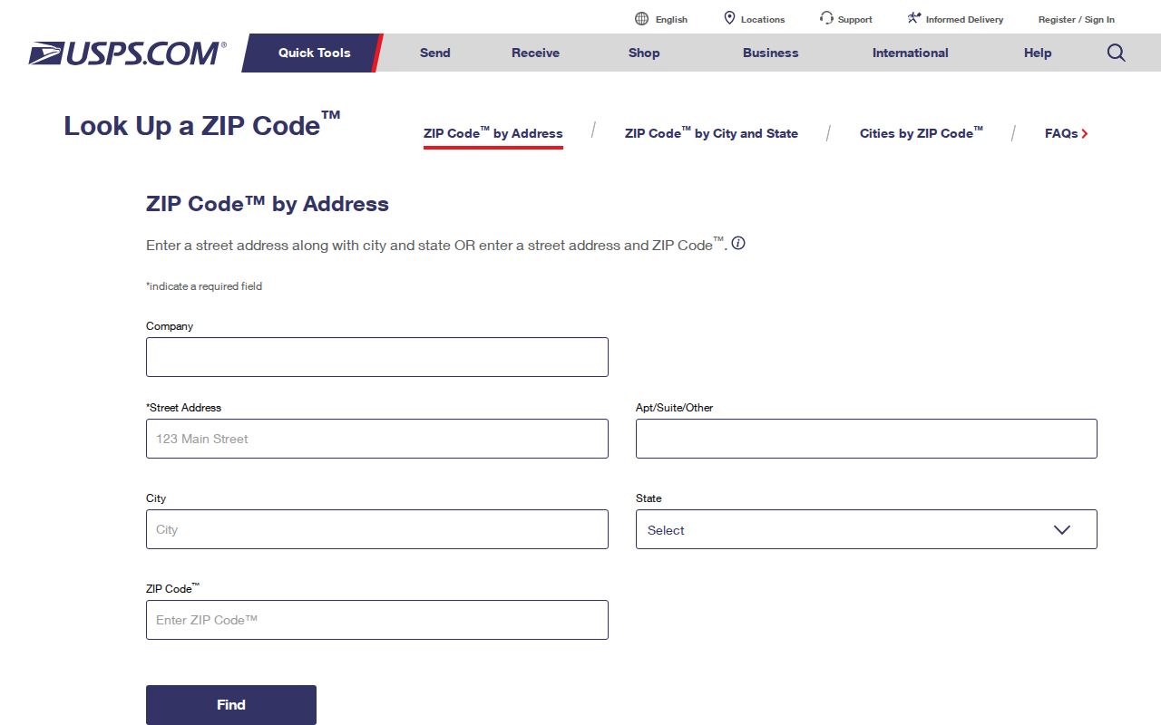
The postal result establishes delivery routing. County parcel records must still establish ownership, situs, and city jurisdiction.
Port St. Lucie ZIP Event Records
The city's garage-sale register is an unusual ZIP-capable source. It publishes a permitted sale address, ZIP, start and end dates, times, and broad item categories. Open-house results also show an address, ZIP, dates, and property filters, with a third-party accuracy warning. Neither record is a resident list.
| Captured result field | What it establishes |
|---|---|
| Address | The location tied to the dated city event |
| ZIP | The postal zone displayed for the event |
| Start and end | The event's stated date range |
| Time | The permitted or advertised hours |
| Item categories | A broad sale description, not household identity |
The city address-and-ZIP permit search illustrates this narrow use.
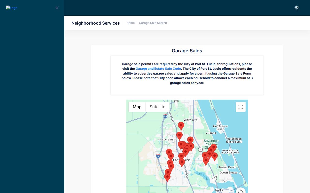
Use the entry to date a municipal event at an address. Do not turn a temporary sale into a claim about permanent occupancy.
Port St. Lucie ZIP Quadrants
NW, NE, SW, and SE are part of Port St. Lucie's official street names. Dropping a prefix can select the wrong parcel. SW Port St. Lucie Boulevard and SE Port St. Lucie Boulevard are not interchangeable search strings. ZIP 34983 itself spans NW and SW examples, proving that postal code cannot safely supply the missing direction.
When a city permit search fails, retain the original address but test the house number or a distinct street token, following the city's advice that less is best. Inspect both current and Legacy Data rows. A duplicate-looking property key can reflect a municipal database migration rather than a duplicate place.
Port St. Lucie ZIP Boundaries
ZIP codes route mail. Municipal boundaries decide which government has jurisdiction. The 34982 edge is a clear warning: Port St. Lucie planning survey responses included the code, yet it remains a Fort Pierce postal area and does not become part of the city wholesale. The sharpest local case is River Park, which abuts the city and shares its social history but remains unincorporated.
Verify a disputed address in two stages. First use USPS for standardized delivery data. Then open the Property Appraiser map and turn on City Boundaries. That distinction matters before asking Port St. Lucie for building permits, code records, or city files.
- ZIP versus ZIP+4
- A ZIP is a broad delivery area. ZIP+4 narrows the routing segment for a specific address.
- PO-box ZIP
- A code used mainly or only for post-office boxes. No local example was verified in the research.
- Unique ZIP
- A code assigned to one high-volume organization. No Port St. Lucie example was verified.
- Carrier route
- A delivery path within a ZIP, not a municipal or neighborhood border.
Note: A Port St. Lucie postal address does not, by itself, prove that City Hall holds the parcel's permit or code record.
Keys Beyond Port St. Lucie ZIP
A postal directory is only one layer of local identification. The USPS address handles delivery. The situs address labels the physical parcel. An owner mailing address routes tax notices and may point elsewhere. The legal description preserves subdivision, lot and block, or metes-and-bounds identity across address changes. Property ID connects county assessment and GIS data.
The City Building search adds another local key: its Property KEY. Searchers may see both current-system and legacy rows for one site. Open both before deciding that no permit history exists. The city recommends entering the house number and street with no special characters, then using less text if the first pass fails. That method is especially useful where quadrant prefixes, old abbreviations, or a changed database format keep an exact string from matching.
Keep all five values when a search matters. A parcel can carry a Port St. Lucie mailing line while lying outside the city, and an owner's tax mail can go to another state. None of those facts alone establishes who occupies the property. Used together, they prevent a broad postal match from becoming a false resident claim.
For a large research request, the Property Appraiser offers free tax-roll and GIS downloads as well as scoped custom data. Its request form asks for contact details and a concise description, and staff follows up to define the work and any cost. That route is more reliable than trying to copy a long list from an interactive map. It also preserves Property ID, the field that joins assessment rows to mapped parcels.